


7 Maps That Illustrate the History of the World
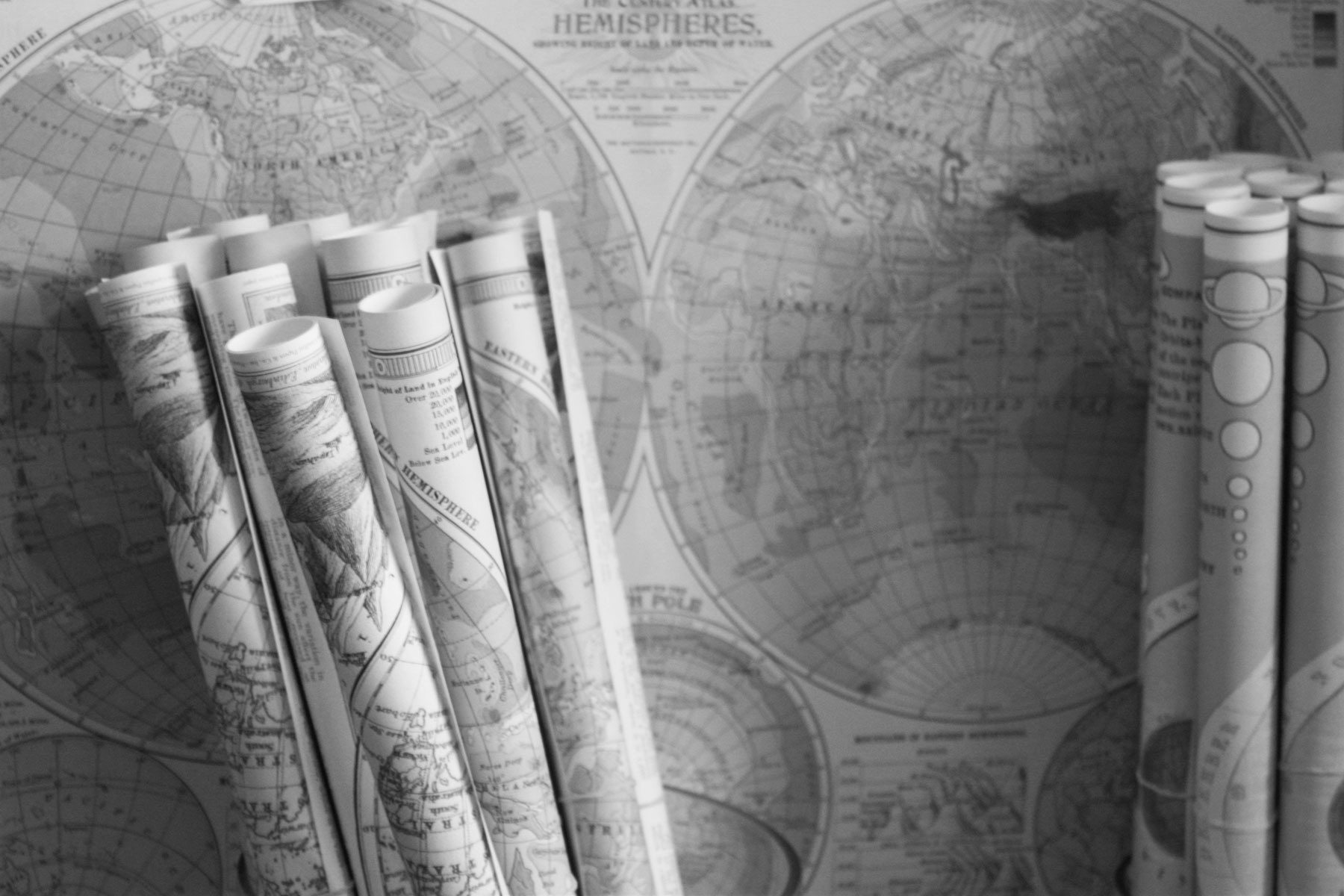
The story of maps is 2,600 years in the making. When the first mapmakers etched the known world into stone, they were completely unaware that their “world” was only a mere fraction of the planet’s surface. As humanity’s knowledge grew, so did the sophistication of maps, whether showcasing the complexity of our cartographic skills or newly discovered regions of the globe. Eventually, mapmakers’ attempts to capture the world on paper evolved into the satellite maps of today, which are so accurate they can give turn-by-turn directions to the grocery store.
These seven historical maps act as a journey through our understanding of the world, each providing an intimate snapshot of the era in which they were made. Some represent cutting-edge mathematics or up-to-date geographic information, while others are a reflection of the very minds that made them, capturing a specific moment in time.
You may also like

More from our network


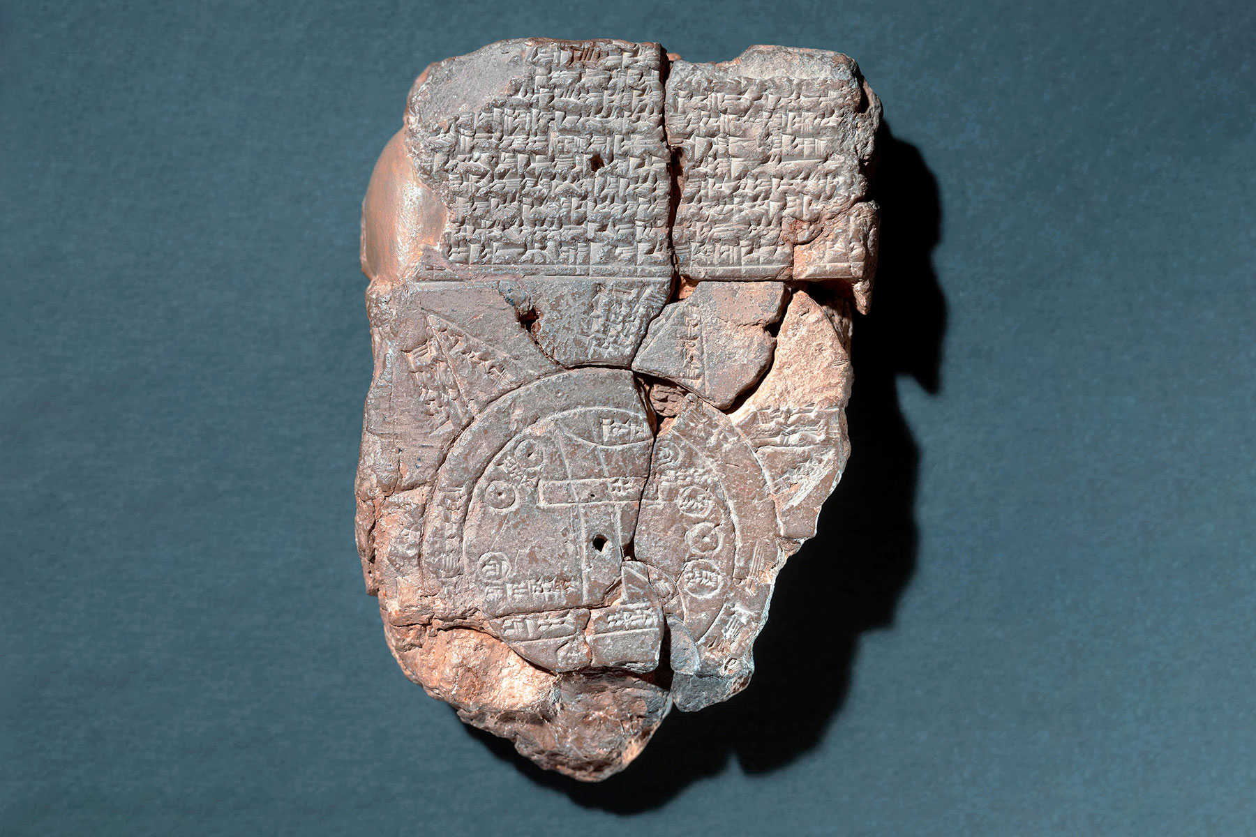
Babylonian Map of the World: The Oldest Known Map
The world’s oldest known map wasn’t so much drawn as etched. Known as the Babylonian Map of the World, this 4.8-inch tablet from around the sixth or seventh century BCE affixes the Mesopotamian city of Babylon, which was likely the most populous city on Earth at the time, smack dab in the center of the map. Although the map represents only a small slice of Earth’s total surface area, scholars believe its creators meant it to contain the contents of the known world at the time. Babylon, depicted as a rectangle straddling two crooked lines representing the Euphrates River, is found at the center, while circles in the margins of the map represent other ancient places, such as Assyria and Elam, and cuneiform inscriptions detail other regions. Originally excavated in the late 19th century, the tablet was acquired by the British Museum in 1882. Experts suspect that the map, while relatively accurate, actually served a religious or mythological purpose in its time. Regardless, the Babylonian Map of the World remains the first serious attempt to conceptualize the geography of the known world.
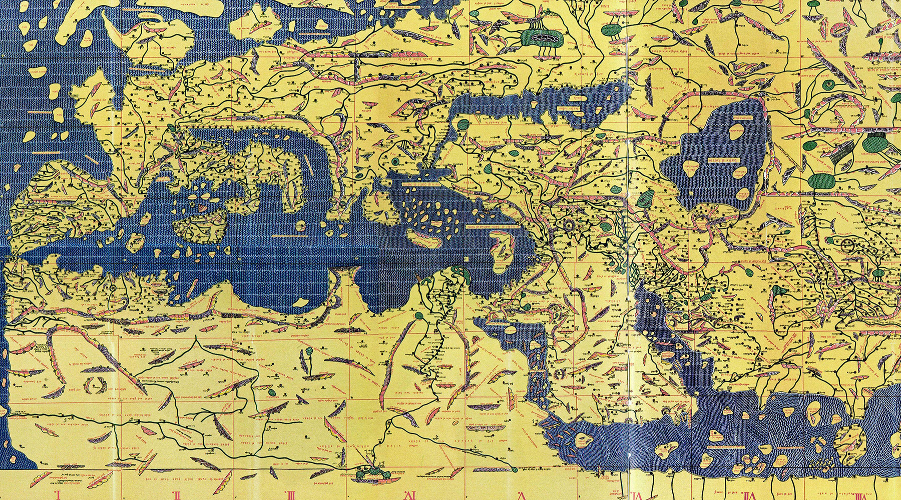
Geographia: An Ancient Blueprint for Mapmaking
Many of history’s major breakthroughs were made by great thinkers standing on the shoulders of other intellectual giants, and Ptolemy’s Geographia, which builds on the scientific advancements of ancient Greek scholars, is no exception. The ancient Greeks were particularly skilled at understanding the world around them. By the fifth century BCE, the famous mathematician Pythagoras understood that the Earth was round, and it wasn’t long before Eratosthenes, another Greek scholar, accurately calculated the planet’s circumference. Centuries later, the Egyptian Greek scholar Ptolemy channeled all these scientific advancements into his masterwork, a collection of maps known as Geographia. Created around the year 150 CE, the eight-volume atlas served as a blueprint for mapmaking during the time of the Roman Empire. Ptolemy detailed the process of projecting a globe-shaped object onto a two-dimensional map, and pinpointed some 8,000 locations throughout Eurasia and northern Africa. He borrowed the concept of longitude and latitude from his mapmaking contemporary Marinus of Tyre, and built on it to make his own lasting contributions to cartography. Ptolemy’s work fueled many of the maps to come during the Islamic Golden Age and Europe’s Renaissance era.
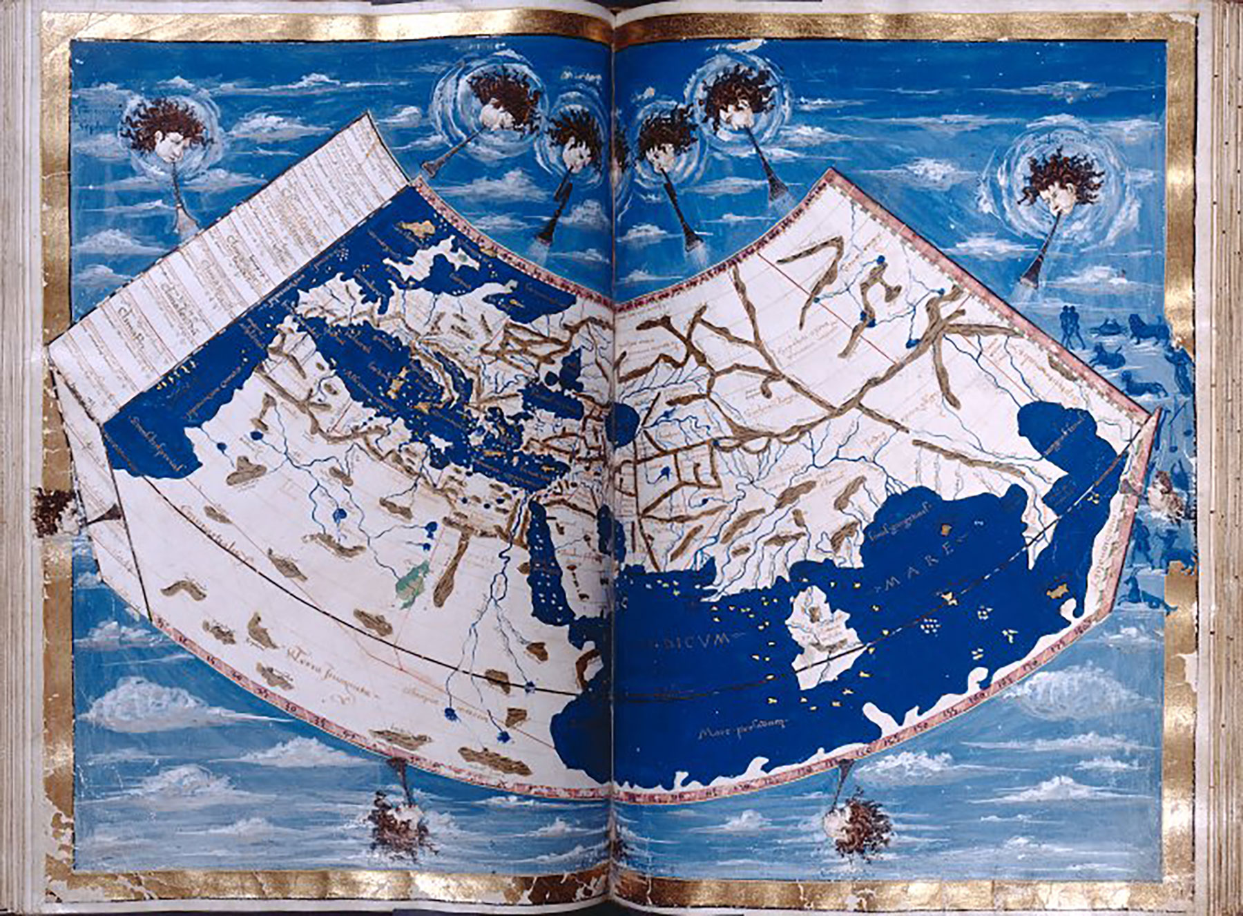
Tabula Rogeriana: A New Level of Accuracy
The Tabula Rogeriana (Latin for the “Book of Roger,” also known as “Kitab Rudjdjar” in Arabic) is an atlas of 70 double-page maps, and it had a singular impact on mapmaking. Composed by the renowned Muslim geographer Muhammad al-Idrisi in 1154 CE, it was initially commissioned by King Roger II of Sicily (hence the name) and is one of the rare examples of scientific cooperation between Christians and Muslims during the age of the Crusades. (In fact, the Second Crusade ended only a handful of years before the map’s publication.) Drawing on Western sources (such as Ptolemy’s Geographia) along with advanced Muslim mapmaking techniques, al-Idrisi created the most accurate collection of maps up to that time — geographic works that were copied for centuries and used by European explorers to navigate the world. Interestingly, the Tabula Rogeriana flips our modern conception of the Earth, as al-Idrisi arranged his map with northern Europe on the bottom, the Mediterranean Sea and northern Africa at the top, and the holy city of Mecca right in the middle.
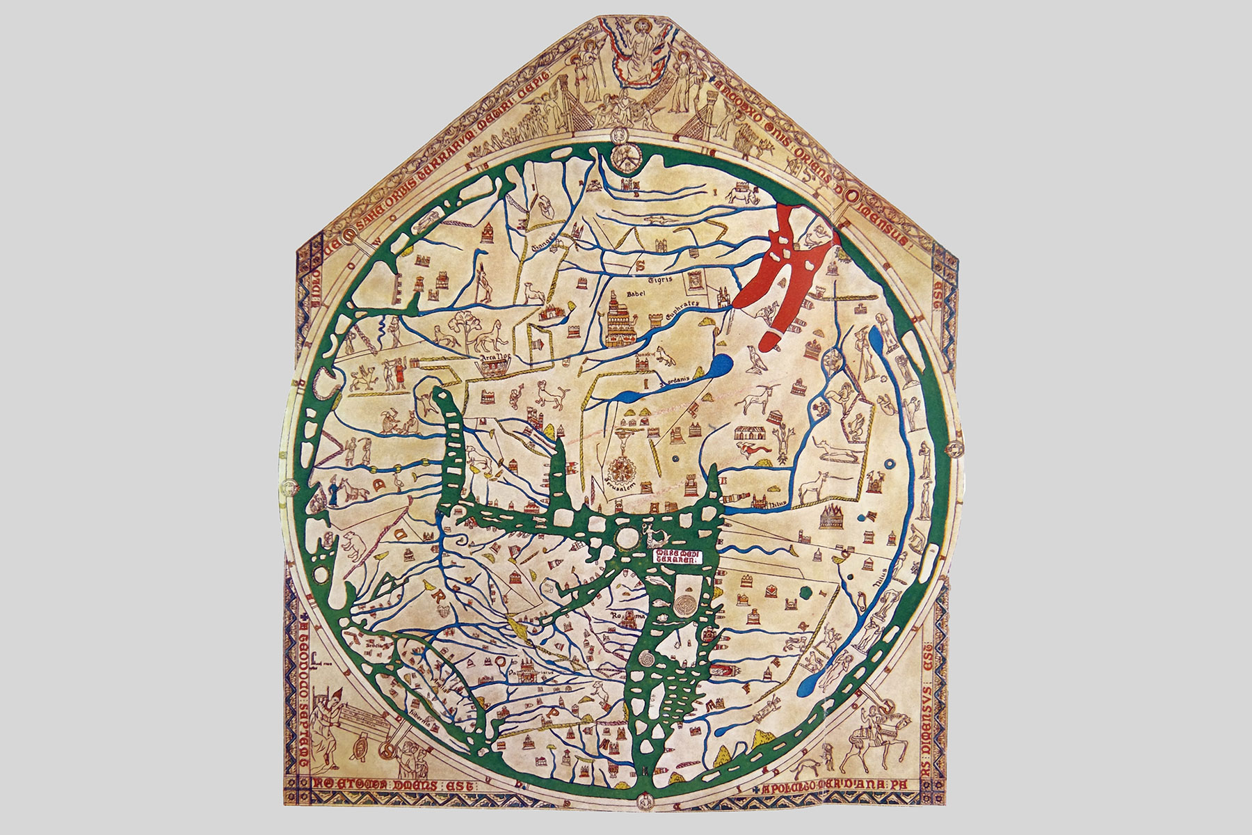
Hereford Mappa Mundi: A Map of the Medieval Mind
While some mapmakers worked to achieve geographic accuracy, others infused religion into their works. The most famous example is the Hereford Mappa Mundi, created around the year 1300. Housed at Hereford Cathedral in England, the roughly 5-by-4-foot map is drafted onto a sheet of vellum (calf skin) and tilts our modern orientation of the world counterclockwise 90 degrees (with east at the top). Early Christian mapmakers often placed the holy land of Jerusalem at a map’s center and due east at the top of the map because they believed it was the direction of the Garden of Eden. (In fact, the word “orientation” derives from the Latin root oriens, meaning “east.”)
As the largest surviving map from the Middle Ages, the Hereford Mappa Mundi offers a rare glimpse into the medieval Christian worldview. It features biblical scenes sketched directly onto the map, the cities of Paris and Rome (Catholic powerhouses of the era) arranged prominently, and mythological beasts, likely pulled from ancient Roman texts, woven throughout. It’s unlikely that travelers used the map for actual navigation, but today it provides an unparalleled roadmap through the minds of its creators, and their unique perception of the known world.
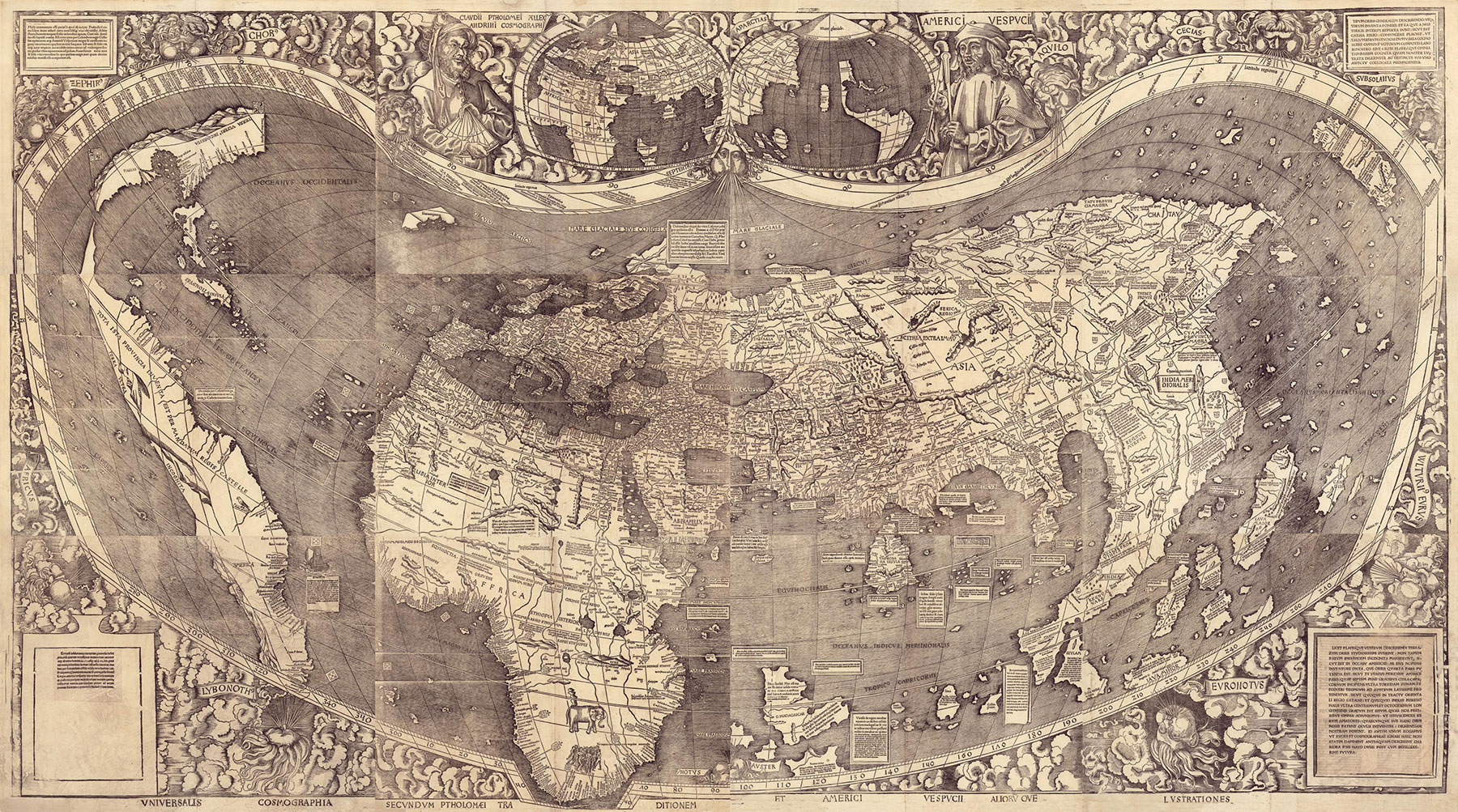
Waldseemüller Map: The First Map to Name “America”
In the 15th century, European explorers discovered a “New World” — a continent across the sea that was previously unknown to them. One of the earliest attempts to map what we now know as the Americas was made by German cartographer Martin Waldseemüller, who created his eponymous map in 1507. The Waldseemüller map included thin stretches of land representing the New World. Although unrecognizable today as North and South America, these geographic additions nonetheless represent the dawn of Europe’s Age of Discovery. The Waldseemüller map was also the first map to use the word “America” to describe the new land. The name was given in honor of the Italian navigator Amerigo Vespucci, believed to be the first European to recognize the Americas as a landmass wholly separate from India (which is where Christopher Columbus thought he landed in 1492). Adopting Vespucci’s theory, Waldseemüller created the first map to depict the Western Hemisphere, and the first to denote the Atlantic and Pacific as separate oceans.
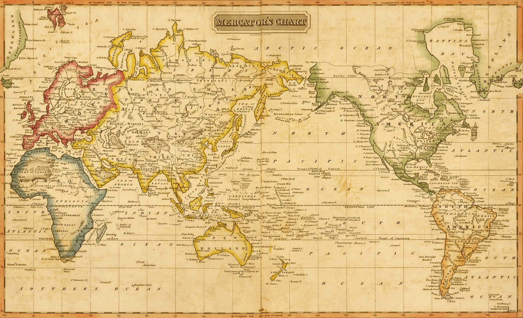
Mercator Projection: The Shape of the Modern Map
The Mercator Projection, created by Flemish cartographer Gerardus Mercator in 1569, is widely recognized as the first modern map. Although the map combined all the geographic discoveries until that point (the Americas are much more than small slivers of land, for example), its greatest gift was solving a centuries-old problem first considered by Ptolemy more than 1,400 years earlier: how to accurately project a spherical globe onto a two-dimensional map. To do this, Mercator drew parallel latitude lines farther and farther apart as their distance from the equator increased. This made an excellent map for explorers, as it made it easy for navigators to plot a straight-line course. The downside of the Mercator Projection is that the exaggerated latitude lines at the poles equally exaggerated the size of the world’s northernmost and southernmost landmasses. For example, Greenland looks almost as big as the entire continent of Africa, when in reality it’s 14 times smaller.
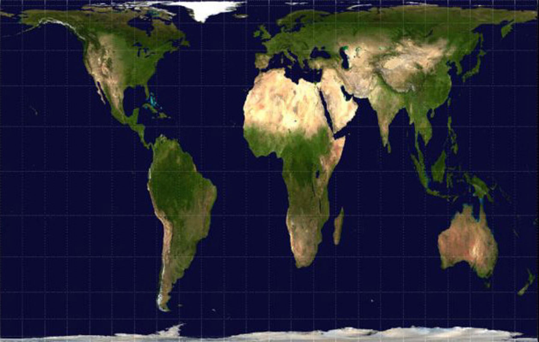
Gall-Peters Projection: Correcting for Geographic Bias
For centuries, the Mercator Projection (with a few geographic updates regarding the Americas) was the standard map used in classrooms around the world, but its distortions gave a similarly distorted view of history — one that by chance inflated the geographic size of the world’s superpowers while deflating the size of many other countries, including nations that were colonized by those same global powers. In the 19th century, Scottish clergyman and cartographer James Gall developed a “cylindrical equal-area projection,” a family of maps that aimed to represent the size of countries on a flat map as accurately as on a globe. German historian Arno Peters brought attention to Gall’s work in the 1970s with the introduction of the similar Peters Projection, igniting a debate around geographic bias in mapmaking. However, similar to the Mercator Projection before it, the Gall-Peters Projection also distorted countries, by stretching them near the equator and squishing them near the poles.
Today, the most accurate world map is a matter of debate. In 1998, for example, the National Geographic Society adopted the Winkel Tripel Projection, a map that reduces distortions in area, direction, and distance. In 2021, astrophysicist J. Richard Gott reimagined the world map by splitting the Earth in half and placing the North and South poles in the center of two connected circles. According to Gott, this approach addresses distortions in shape, area, distance, bending, skewness, and boundary cuts, leading to “the most accurate flat map of Earth yet.” The key word there is “yet”: Some 2,600 years since the first known attempt to map the world, the story of mapmaking may be nowhere near its final chapter.


