6 Facts About Ancient Navigation
Thousands of years ago, the oceans seemed a lot wider, even unnavigable. Before mariners developed tried-and-true navigation techniques, sailing the seas involved a lot of guesswork — or, if you want it to sound cooler, “dead reckoning.”
Slowly, our ancestors moved beyond their initial stabs in the dark. Some looked to the sky, using their new knowledge about the cosmos to help them better understand life on Earth. Others took a keen interest in the seas, learning to intuitively navigate the vast expanses based on their currents and swells.
Nowadays, we have a relatively easy time getting around — thanks, GPS! — but it took a long time to get here. How were Polynesians able to cross thousands of miles of open ocean more than 3,000 years ago? Which seafaring society might have successfully used crystals to find their way? What persistent navigation myth just won’t die? Read on and get your sea legs with these six facts.
Polynesians Were Pioneers of the Open Ocean
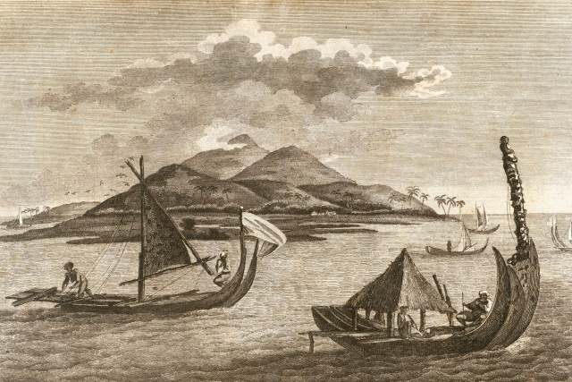
In the early days of ocean navigation, explorers stayed pretty close to the shoreline and used visible landmarks to mark their position. However, Polynesians, the first developers of open ocean exploration, set off from New Guinea and moved eastward in about 1500 BCE. After first traveling to the adjacent Solomon Islands, they gradually journeyed farther and farther east. Their vessel of choice was a double canoe with two hulls connected by crossbeams, kind of like a catamaran.
Venturing out into the open ocean, these explorers eventually reached Fiji, Tonga, Samoa, and Tahiti. They then traveled more than 2,600 miles north to Hawaii — longer than the distance across the U.S. from Portland, Maine, to Seattle, Washington. By roughly 1,000 or possibly 1,200 CE, the descendants of those early explorers populated the entire Polynesian Triangle, the three corners of which are Hawaii, Rapa Nui (aka Easter Island), and New Zealand.
The Polynesians didn’t have any navigational instruments that we know of, so how did they do it? Although their navigation techniques were passed down orally, historians think they navigated using stars, ocean swells, the sun, the moon, and migratory birds. Some Pacific Islanders navigated simply by using the waves themselves. In 1976, a group of Polynesian canoeing enthusiasts made the Tahiti-Hawaii trip using no navigational instruments and a traditional voyaging canoe — a feat that’s since been repeated several times.
Some Early Nautical Charts Were Made From Shells and Sticks
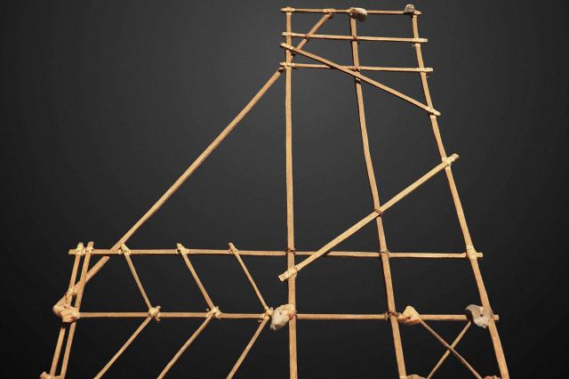
A nautical chart provides not only topographical information, but also details about the behavior of the sea, such as how tidal patterns interact. Today, we can easily read this data on screens and paper, but ancient Micronesian navigators called ri-metos recorded their knowledge using elaborate “stick charts” made from palm strips, coconut strips, and cowrie shells.
As you might imagine, these charts weren’t especially portable, so they were designed to be memorized before a voyage. The charts didn’t follow any kind of uniform style, and some of them were only designed to be read by the person who created them, so they can be hard for modern viewers to interpret. We do know, though, that some charts depicted general ocean patterns, while others contained precise piloting instructions.

